The Aylesbury Canal Arm - England.
Information and Photos about the towpath, walks, bridges, feaures and locks on the Aylesbury Arm of the Grand Union Canal in England.
 The Aylesbury Arm starts off from The Grand Union Canal at Marsworth Junction (at the canal bridge along Watery Lane [HP23 4LY] i.e. close to the B489) and runs for 10 kilometres across the countryside to arrive in the centre of Aylesbury in Buckinghamshire.
Completed in 1815 the intention was to use the Aylesbury Canal Arm as part of a through connection between The Grand Union Canal and the River Thames at Abingdon - and thus ultimately create a possible route for narrowboats and barges through to Bristol via The beautiful Kennet and Avon Canal and the Wilts and Berks Canal.
 These plans were argued over for around 17 years before the Aylesbury Arm was started - with one of the biggest issues being the scarcity of water supply. The Aylesbury Arm as a "through connection" would have required a supply of water from another source which would have to be from The River Thames (Aylesbury lies in a hollow) - in the end this through connection never did happen.
The photo above right shows just how beautiful our English canals can be particularly in the Spring and Autumn - it was taken from the canal's towpath whilst approaching Black Jacks Lock (i.e. walking towards the Marsworth end of the canal).
These plans were argued over for around 17 years before the Aylesbury Arm was started - with one of the biggest issues being the scarcity of water supply. The Aylesbury Arm as a "through connection" would have required a supply of water from another source which would have to be from The River Thames (Aylesbury lies in a hollow) - in the end this through connection never did happen.
The photo above right shows just how beautiful our English canals can be particularly in the Spring and Autumn - it was taken from the canal's towpath whilst approaching Black Jacks Lock (i.e. walking towards the Marsworth end of the canal).[ Click the thumbnails for a larger picture - use the back button to return to this page. ]
 The Aylesbury Canal Arm drops a total of 95 feet on it's way to Aylesbury with most of it's 16 narrow 7 feet locks situated towards the Marsworth end
of the canal. The Arm was used commercially for transport of a variety of goods including grain, timber, coal and building materials until the 1960s.
The Aylesbury Canal Arm drops a total of 95 feet on it's way to Aylesbury with most of it's 16 narrow 7 feet locks situated towards the Marsworth end
of the canal. The Arm was used commercially for transport of a variety of goods including grain, timber, coal and building materials until the 1960s.Unusually the Aylesbury Canal Arm has a pair of narrow Staircase Locks.
The first locks are located right at the start of the Canal as you leave Marsworth Basin - these two canal locks are staircase locks which is where the middle gate joins the top and bottom locks. This type of canal lock is unique on the Grand Union Canal's Southern Waterway.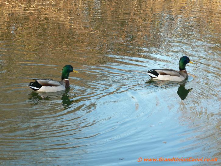
Canal wild life

Marsworth Junction

Marsworth No. 1 Lock (staircase lock)

Marsworth No.2 Lock

Marsworth Lock 2
and Bridge 1

Bridge No.1 - Aylesbury Arm.

Marsworth No.3 Lock

Black Jacks Lock No.4

The Aylesbury Arm, Lock No.5

Aylesbury Arm Lock6

Pipe Bridge nr Bridge 2

Dixons Gap Bridge No.2

Lock No.7

Lockgates at Lock7

Jefferies Lock No.8
 Near
NearWilstone Bridge No.3
 Although the Waterways Authorities are keen to promote themselves as encouraging various leisure activities on their canals the fact is that the Aylesbury Arm's towpath is in something of a poor condition in various places. When last walked (September 2014) the towpath has several short stretches which suffer from partial bank collapse and several deep mud
filled holes. After heavy rain in at least two locations this can cause the canal to leak across the towpath into adjacent field ditches. So if you add to this leakage problem some wet weather
and a subsequently very soggy towpath it's evident that walking becomes quite difficult to say the least and for cyclists pretty hazardous.
Although the Waterways Authorities are keen to promote themselves as encouraging various leisure activities on their canals the fact is that the Aylesbury Arm's towpath is in something of a poor condition in various places. When last walked (September 2014) the towpath has several short stretches which suffer from partial bank collapse and several deep mud
filled holes. After heavy rain in at least two locations this can cause the canal to leak across the towpath into adjacent field ditches. So if you add to this leakage problem some wet weather
and a subsequently very soggy towpath it's evident that walking becomes quite difficult to say the least and for cyclists pretty hazardous.
Footbridge No.4

Lock No.9

Gudgeon Lock

- Bridge No.5

Canal Bridge no.6

Puttenham Top Lock No.10

Puttenham Top Lock
Lock Gates

Puttenham Bottom Lock No.11

Bridge No.7

Aylesbury Arm Barges

Puttenham Bottomlock
lockgates

Aylesbury Arm - Bridge No.8

Buckland Lock No.12

Buckland Lock Gates
near Aylesbury

Red House Lock No.13

Red House Lock

Gates at
Red House Lock

Canal Bridge no.9

Bridge No.10

Canal Bridge 11

Bridge no 12

The Towpath

Bridge No.13

Bridge No.14

Broughton Lock No.14

Bridge No.15

2 Pipe Bridges

Bridge No.16
Options for one-way walking along The Aylesbury Canal Arm Towpath in England.
Despite the towpath being a bit "iffy" in a few places a walk along the canal does go through some lovely and often remote countryside however a there-and-back walk is around 13 miles so quite a long way. An option is to get a bus to one end or the other and then wander back. Bus service 164 operates from Aylesbury and from Leighton Buzzard - this runs every couple of hours during the day and the bus stop at Marsworth is right next to the Grand Union Canal. There is a medium size car-park at Marsworth (chargeable at UKstg3 per day (Autumn 2014 price)) - so a possibility is to park there and get the 164 bus into Aylesbury and walk back.
ugly concrete bridge

Osier Bed Lock No.15

Bear Brook goes under the Arm

Hills Partridge Lock
No.16

Circus Field Basin

Pipe Bridge next
to Bridge 17

Bridge No.17

Bridge No.18

 The end of the canal at Aylesbury is undergoing renovation - there is a huge superstore and it's carpark on one side and more building work is slowly occurring around the rest of it.
The Basin no longer looks as nice as the photo on the left at the moment and there are just a few boats moored there.
The Aylesbury Arm is a very popular venue for fishermen - unlike English rivers which have a close season you can of course fish all the year round on the canal - and at least the towpath is generally wide enough to give everyone room for their pursuits. For narrowboats the canal is quite straight in direction and generally wide enough for passing although it is very silted in some places with reeds protruding well out into the stream. There are turning points at Marsworth, another at Bridge 9, a winding can be done at Circus Field Basin and again at the Arm's end in Aylesbury (this latter turnpoint is quite congested due to quite a few moored canal narrow boats).
- Our topics mentioned above or which are somewhat related to the Aylesbury Arm are:
- Grand Union Canal in England Home Page - covering all of the Grand Union Canal and it's Arms and Sections.
- The Grand Union Canal at Bulbourne Tring Summit plenty of wildlife, lots to see and walk around here.
- The Wendover Canal Arm which leaves from Bulbourne Junction - a beautiful mostly tree-lined canal packed with wildlife.
- Tring Reservoirs Walk along Towpath and Paths in Buckinghamshire, England
- Walks around the Wendover area in England - Wendover Woods, The Ridgeway and Oxfordshire Way.
- The Thames Path between Abingdon and Culham particularly related to The Thames at Abingdon and Culham.
- The beautiful Kennet and Avon Canal - excellent to walk on it's way from Reading to Bristol.
Via our Site Resources topic there is a menu showing more watery topics - The Regents Canal and The Stratford-upon-Avon Canal.
Visit GUC Resources if you wish to Contact Us. You may also wish to see our website Cookies and Privacy Policy.
More about the Canal Arm? - take a look at The Aylesbury Canal Society Website - very interesting.
Visit GUC Resources if you wish to Contact Us. You may also wish to see our website Cookies and Privacy Policy.
More about the Canal Arm? - take a look at The Aylesbury Canal Society Website - very interesting.