The Wendover Canal Arm in England.
 Towpath walks, features, locks and bridges plus photos and information about the really beautiful Wendover Arm of The Grand Union Canal.
A little bit about where it is located and the history of the Wendover Canal Arm.
The Wendover Arm is a 6.5 miles (11km) long partially navigable contour canal which leaves the Grand Union Canal at Bulbourne Junction (Marsworth Lock Flight) and goes through to the small Buckinghamshire town of Wendover. It was originally designed to be a feeder arm to provide scarce water for the Grand Union Canal Main Line canal system (Tring Summit) which is around 400 feet above the River Thames at this point.[ Click the thumbnails for a larger picture - use the back button to return to this page. ]

Bulbourne Dry-dock

Bulbourne Junction Bridge

Canal Sluice

Gamnel Bridge
Construction commenced in 1793 however the plans were soon altered as it was realized that the feeder arm could be made to be navigable at little extra cost. However not long after completion it then became apparent that the Wendover Arm was leaking water particularly from Little Tring to near Drayton Beauchamp. Despite several fixes over the years the water loss soon became greater than the amount that was actually being provided to the Grand Union Canal. Ultimately in the 1800s the Wendover Arm was sealed by use of a stop lock
at Little Tring - with the result that barges had no guarantee of depth from the lock on into Wendover. Subsequently the water being provided by the various springs around Wendover was culverted and the canal arm remains dry between Little Tring Farm and a little before Drayton Beauchamp Bridge.
Following restoration work the stop lock has now all but disappeared and the Wendover Arm is navigable for narrow boats from Bulbourne Junction Bridge to several 100 yards past Little Tring Bridge no.3 where there is a good sized turning point. The original Little Tring Bridge was built by William Jessop around 1797 however in 1973 the bridge was demolished due to it's poor state of repair. The Wendover Canal Trust subsequently agreed to finance a large part of it's re-instatement and Little Tring Bridge was officially opened in May 2001. The bridge was re-constructed to the same design as Jessop's original version and has a lovely arch and beautiful brickwork. Incidentally right next to Gamnel Bridge there is a nice looking old flour mill which has excellent brickwork and the mill is still in full commercial use. Narrow boat owners should be very aware that a ledge runs just beneath the water-line on the mill side of the canal.

Mill Buildings on the Wendover Canal

Tringford Pumping Station

Stop Lock remains

Little Tring Bridge no.3
Reservoirs and the leaky Wendover Canal Arm.
Between 1806 and 1817 Marsworth, Tringford and Startop End reservoirs were added to help provide a water supply for the Main Line and the water was pumped through via Tringford Pumping Station which remains operational. The Pump Station is still there and is located close to Little Tring Bridge. A further reservoir was added a few years later which is the 70 acre Weston Turville Reservoir and is situated about half way along the Wendover Arm - the reservoir is designated a Site of Special Scientific Interest.
Winding Hole

Pat Saunders footbridge no.4
Remains of a
pump station

Chiltern footbridge 4a
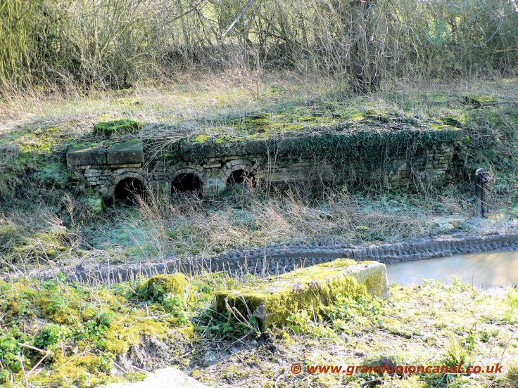
The old pump house at Whitehouse on The Wendover Arm.
The photo above third from the left shows the inlets where one of the Wendover Arm's three pumping stations was situated at Whitehouse. This is as the Whitehouse Pump Station looked in 2008 - The Wendover Canal Trust (who are in the process of restoring the Wendover Arm) are involved in restoring some of the Pump Station brickwork to it's former glory - their website is very much worth visiting.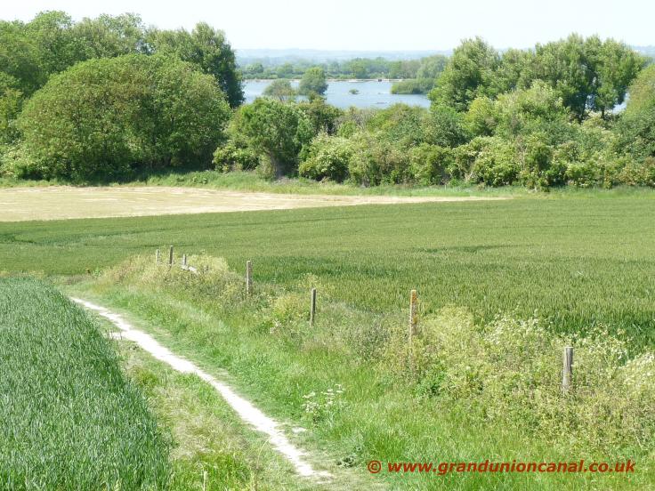 There were also pump-houses at Bulbourne (now there is no sign of it's existance) and one which is still in operation at Little Tring (see further above). Basically the pumps were used to divert water not needed for the Grand Union Canal (Tring Summit) into the adjacent reservoirs - the canal arm is considerably higher up than the reservoirs so this was easily achieved by gravity. The photo on the right shows a somewhat distant view of the huge Wilstone Reservoir
which is situated much lower than the Canal Arm. Wilstone Reservoir - now home to many different species of wild birds and very a very popular venue for fishermen - was constructed in 1802 and covers 119 acres.
There were also pump-houses at Bulbourne (now there is no sign of it's existance) and one which is still in operation at Little Tring (see further above). Basically the pumps were used to divert water not needed for the Grand Union Canal (Tring Summit) into the adjacent reservoirs - the canal arm is considerably higher up than the reservoirs so this was easily achieved by gravity. The photo on the right shows a somewhat distant view of the huge Wilstone Reservoir
which is situated much lower than the Canal Arm. Wilstone Reservoir - now home to many different species of wild birds and very a very popular venue for fishermen - was constructed in 1802 and covers 119 acres.
Towpath at Drayton Beauchamp
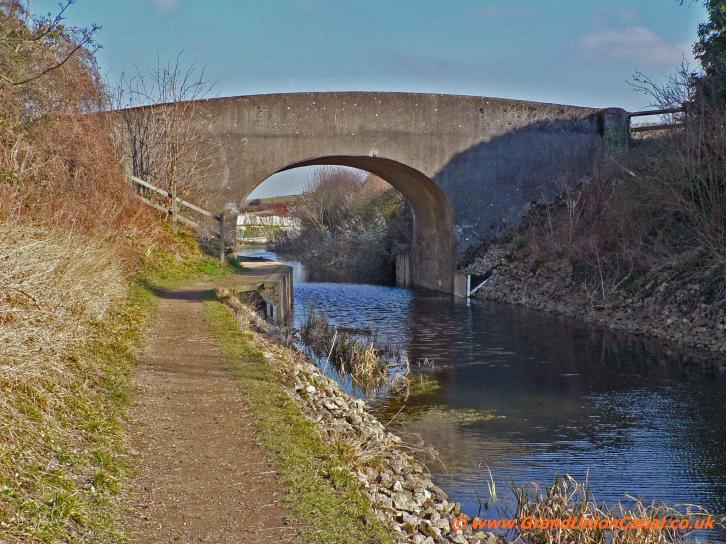
Drayton Beauchamp Bridge 5

Drayton Beauchamp Church

One end of the old canal route
Just above there is a picture of Drayton Beauchamp's Church of St. Mary The Virgin - this beautiful old church can just be seen from the towpath of the Wendover Arm - but only in the winter before the heavy foliage blanks the view out. To find the church then if heading towards Wendover and having gone under Bridge 5 look for wooden steps going up the bank a few 100 yards along. The church is in a peaceful beautiful setting - lots of lovely trees, buttercup fields populated by not very active sheep,
Red Kites around and there are several bench seats at the church.
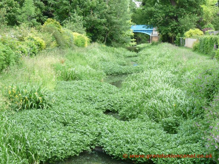
From Drayton Beauchamp Bridge on into Wendover the Arm is quite shallow, heavily silted and full of undergrowth with gorgeous trees bordering it's sides for much of the way however it is still wet and therefore a haven for wildlife. The towpath is generally in excellent condition for walkers and for cycling and there are a considerable amount of paths linking onto the towpath which makes for some really good circular hiking trips.
From Drayton Beauchamp Bridge on into Wendover the Arm is quite shallow, heavily silted and full of undergrowth with gorgeous trees bordering it's sides for much of the way however it is still wet and therefore a haven for wildlife. The towpath is generally in excellent condition for walkers and for cycling and there are a considerable amount of paths linking onto the towpath which makes for some really good circular hiking trips.

Saxon Way Bridge

Old Canal Arm route

Buckland Wharf footbridge

A41 culvert.
 The Wendover Arm has received only one short diversion which occurred when the canal was diverted a short distance to allow the new road (A41) to cross the canal using Saxon Way Bridge.
Just around here is perhaps one of the most beautiful parts of the Wendover Arm - many gorgeous trees and the towpath is bordered by many wild flowers. Walkers and cyclists need to be careful for several 100 yards after Wellonhead Bridge because the towpath has collapsed somewhat into two levels.
 The photo on the right is of The Narrows which is is where the Arm passes Aston Clinton House - the concrete wharf is just below the water line now and travels for some distance - perhaps long enough to allow 3 to 4 narrow boats to be unloaded. The entire Wendover Arm is full of wildlife however as you pass by the reed beds and particularly from Harelane Bridge and getting nearer to Wendover
itself there are quite a number of ducks, coots, moorhen and swans living on and around The Arm. Much of this wildlife and in particular the ducks do expect to be given food and might well blockade the towpath until their "bread toll" is paid.
The photo on the right is of The Narrows which is is where the Arm passes Aston Clinton House - the concrete wharf is just below the water line now and travels for some distance - perhaps long enough to allow 3 to 4 narrow boats to be unloaded. The entire Wendover Arm is full of wildlife however as you pass by the reed beds and particularly from Harelane Bridge and getting nearer to Wendover
itself there are quite a number of ducks, coots, moorhen and swans living on and around The Arm. Much of this wildlife and in particular the ducks do expect to be given food and might well blockade the towpath until their "bread toll" is paid.
Near The Narrows

Harelane Bridge
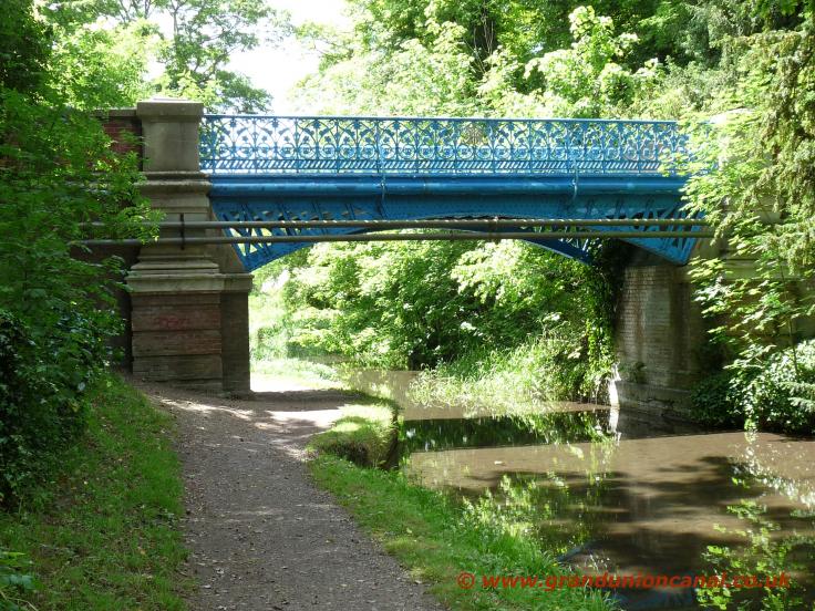
Rothschilds Bridge
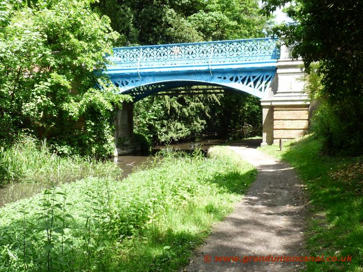
Bright blue Rothschilds Bridge
 The Wendover Arm towpath changes sides at Halton Bridge - the canal here is quite heavily silted up and therefore full of reeds and growth - in places you can hardly see the stream. This is also a very picturesque spot with several lovely old cottages nestled beside the canal. It is worth diverting from the canal and visiting Halton's old Church of St. Michael and All Angels which is a Grade II listed building. To find it go onto the bridge, turn left and the double wooden gates leading into the church yard are a couple of hundred yards along on the left.
Halton Bridge

Perch Bridge

Perch Bridge and Pipebridge

ex railway siding
There is a nice example of a canal pipe bridge by Perch Bridge (see above). Even these pipe bridges have much more thought and design in them than the concrete - no thought on design just pour the concrete everywhere - mess that are often built today and sometimes sadly cross our lovely old canals and canal arms.
The "ex railway siding" photo above is the path of a railway line which once went from Wendover Station to Halton Camp - the original railway bridge crossing the Wendover Arm now replaced with a very narrow wooden footbridge. In all there were 1.75 miles of railway line and sidings all constructed by German POWs and it opened in 1917 - the line was also used extensively during WWII - and was eventually closed in 1963.
The "ex railway siding" photo above is the path of a railway line which once went from Wendover Station to Halton Camp - the original railway bridge crossing the Wendover Arm now replaced with a very narrow wooden footbridge. In all there were 1.75 miles of railway line and sidings all constructed by German POWs and it opened in 1917 - the line was also used extensively during WWII - and was eventually closed in 1963.

Wendover Arm footbridge

Wildlife

Wendover Basin.

Heron Stream
The Wendover Arm perhaps not that unsurprisingly ends up in the small Buckinghamshire town of Wendover itself - where Heron Stream feeds into the canal. Be careful when walking or cycling along the towpath around here especially for the first several hundred yards. The towpath - although quite wide - has somewhat detiorated - it slopes towards the water and is almost on a level with the canal itself - so slippery if wet or icy.
To go into the centre of the town then from the end of the towpath turn right up to a main road and then left to arrive at Wendover's Clock Tower.
To go into the centre of the town then from the end of the towpath turn right up to a main road and then left to arrive at Wendover's Clock Tower.
- Our items mentioned above or which are somewhat related to the Wendover Canal Arm are:
- Grand Union Canal in England Home Page - covering all of the Grand Union Canal and it's Arms and Sections.
- The Grand Union Canal at Bulbourne Tring Summit plenty of wildlife, lots to see and walk around here.
- The Aylesbury Canal Arm which leaves from nearbye Marsworth Junction and can be walked along to Aylesbury..
- Tring Reservoirs Walk along Towpath and Paths in Buckinghamshire, England
- Walks around the Wendover area in England - Wendover Woods, The Ridgeway and Oxfordshire Way.
- The Thames Path between Abingdon and Culham particularly related to The Thames at Abingdon and Culham.
Via our Site Resources topic there are links to our topics on the beautiful Kennet and Avon Canal, Stratford-upon-Avon Canal and Regents Canal.
Visit GUC Resources if you wish to Contact Us. You may also wish to see our website Cookies and Privacy Policy.
Visit GUC Resources if you wish to Contact Us. You may also wish to see our website Cookies and Privacy Policy.